Hiking Ben Chonzie, one of Scotland’s easiest Munros, made for the perfect October hike, from a gradual climb to unexpected magic above the clouds.
I wanted a hike that would feel like a proper achievement without being too challenging or time-consuming – and one that wasn’t too far from the east coast of Fife (where I was coming from). Ben Chonzie ticked all the boxes, so on a Sunday afternoon in October, this is the hike I set out on.
I’m really glad I did. While the views aren’t generally considered as impressive as some other easy Munros, and the walk itself is more steady than “exciting”, I loved my day on the mountain. As it turned out, this Munro provided a pretty memorable moment in terms of views – a little bit of unexpected magic once through the mist!
In this post, I’ll cover all you need to know to plan your Ben Chonzie hike, plus my experience on the route and what to expect.
Ben Chonzie Hike – What to Know
First, here’s some practical info to help you plan your Ben Chonzie hike, including distance, time, elevation gain, parking, and difficulty.
How High Is Ben Chonzie?
Ben Chonzie stands at 931 metres, placing it just above the 914.4m (3,000ft) threshold required to qualify as a Munro. This makes it one of Scotland’s lower Munros.
Despite its height, the total elevation gain is actually only around 700 m from Glen Lednock car park (the most popular starting point and where I began my climb). To put this into perspective, other beginner-friendly Munros such as Ben Vorlich (Loch Earn) and Ben Lomond have elevation gains of roughly 877 m and 950 m, respectively. This lower elevation gain is one of the reasons Ben Chonzie is often recommended for first-time Munro baggers, especially in good conditions.
What Distance is the Ben Chonzie Hike?
Ben Chonzie’s out-n-back route from Glen Lednock car park is around 8 miles.
How Long Does it Take to Climb Ben Chonzie?
At a good pace, you can make the round trip in around 3-3.5 hours. At a more relaxed pace, expect the hike to take 4-5 hours.
Where is Ben Chonzie Located?
Ben Chonzie lies near the village of Comrie, just outside Crieff, in Scotland’s Southern Highlands.
🏨 These villages make convenient bases for walkers, with a range of accommodation options nearby. In Comrie, a popular choice is The Royal Hotel, while Crieff, being a livelier town with more options, has hotels such as The Murray Park Hotel and Crieff Hydro.
Where to Park for Ben Chonzie?
The car park at Glen Lednock (Invergeldie) is the most popular starting point for hiking Ben Chonzie. It’s not a ‘proper’ car park – you follow a single-track road from Comrie and then find a spot on a grassy verge to park.
On busy days, such as weekends, or in sunny weather, finding a space can be more challenging. It’s generally recommended to arrive early to get parked.
For me, arriving later in the day also worked fine, as most hikers were already leaving or had left. Coming later can also take the stress out of busy car parks, but be safe and give yourself enough time to return before dark. I came prepared in case I got caught in low light (which I did a little at the very end), am fairly fit and can walk quickly (I even ran a bit on the way back down!), and wasn’t alone.
💡 Practical Tip – Toilets
There are no toilets between Comrie and the summit, so plan a stop beforehand. In Crieff, the public toilets are currently closed (2025), but The Square Bar & Kitchen participates in Perth & Kinross Council’s Comfort Scheme, allowing you to use their facilities (opens from 12 pm). In Comrie, public toilets are available, but note their limited opening hours.
How Difficult Is Ben Chonzie Compared to Other Munros?
Ben Chonzie is widely regarded as one of the easiest Munros. Thanks to its well-maintained gravel track and steady, gradual ascent, it’s ideal for beginners. Compared to hills like Ben A’an, or even popular starter Munros such as Ben Lomond, the route is less steep, less rocky, and can usually be completed more quickly.
Ben Chonzie was only my third Munro – my first being Ben Lomond (via the tourist trail) and my second Ben Vorlich (Loch Earn). Out of the three, all of which are considered ‘easy’, I personally found Ben Chonzie the easiest. The part I found challenging wasn’t the climb itself, but the navigation across the wide summit area, which lacks any clear defining features – extra care is needed to stay on route.
Ben Chonzie at a Glance
- Distance: ~8 miles (out-and-back from Glen Lednock)
- Elevation Gain: ~700 m
- Time: 3–5 hours depending on pace
- Difficulty: Easy for a Munro, but summit navigation requires care
- Parking: Glen Lednock (Invergeldie) – arrive early on busy days
- Toilets: None on the route; plan a stop in Comrie or Crieff
- Best for: First-time Munro walkers or those looking for a gentle, well-marked climb
⚠️Summit Navigation: Wide, featureless summit requires careful navigation.
Weather & Season Advice
- Best Season: Late spring to early autumn (May–September) for dry paths and longer daylight
- Winter Hiking: Possible with the right gear and experience, but paths may be icy or snow-covered
- Visibility: Summit is wide and open; poor visibility can make navigation tricky
- Weather Tip: Check local forecasts before heading out and dress in layers; Highland weather can change quickly
My Experience Hiking Ben Chonzie ft. Cloud Inversion – What to Expect
Here’s an insight into my experience hiking Ben Chonzie, so you know what to expect – from the easy start to the disorientating summit plateau, and the unexpected reward that was waiting above the clouds on my visit!
Setting Off (A Late Start & Quiet Trails)
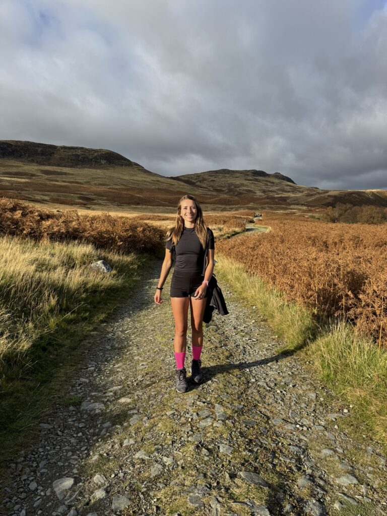
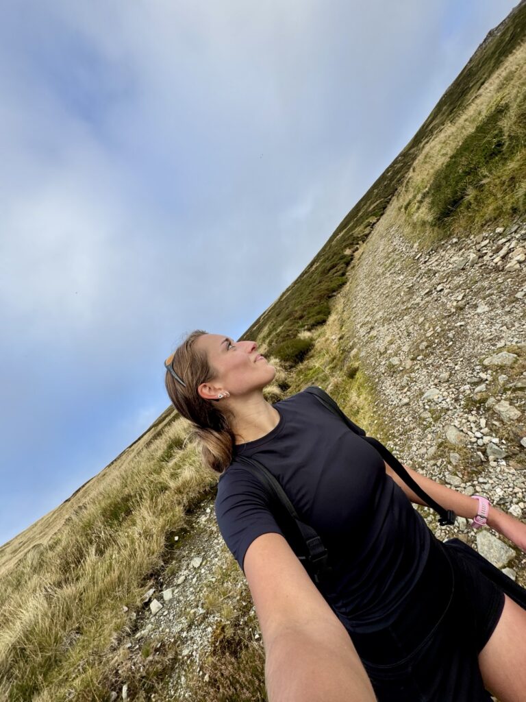
I (well, my Mum and I!) set off from Glen Lednock car park at around 3:45pm on the 12th of October. By then, most hikers had already left or were back at their cars, and those we did pass were on the final stretch of their Munro adventure, while ours was just beginning.
Racing the Light (Timing Matters)
Sunset at this time of year is around 6:20pm, so with less than three hours until the light would leave the sky, the big question was: would we make it up and down before dark? Would we even have time to reach the summit — not wanting to be high on the mountain as night fell! But there was never really any doubt, just determination to do what we had set out to do: bag a Munro!
Under an October Sky (Unpredictable Weather)
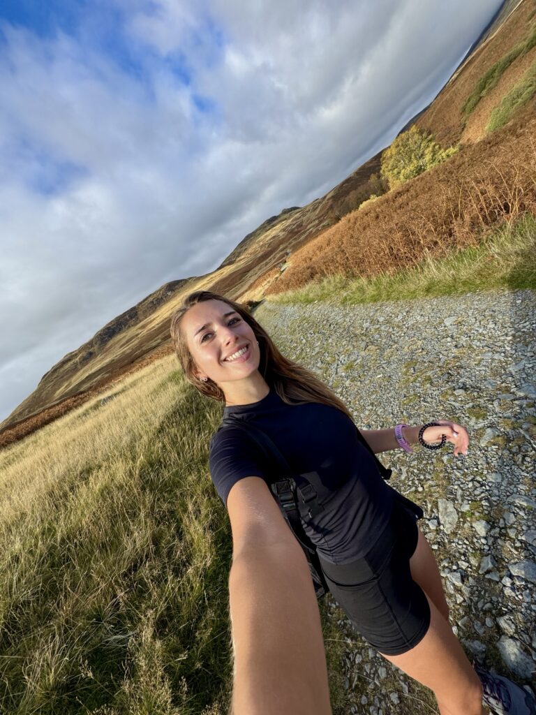
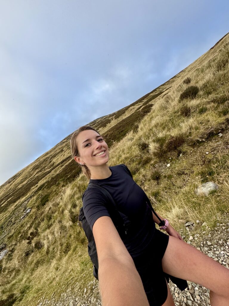
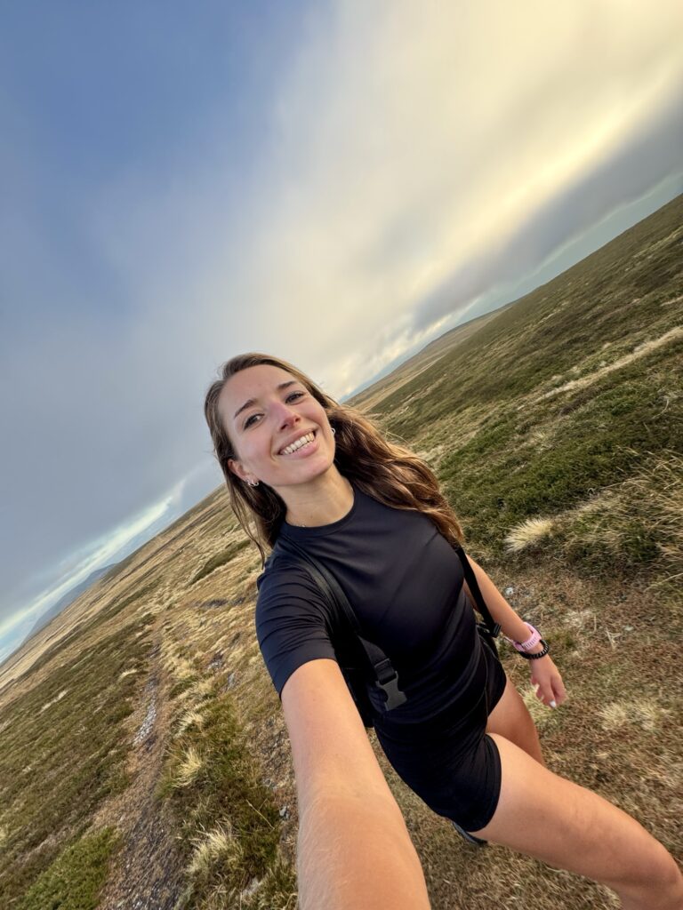
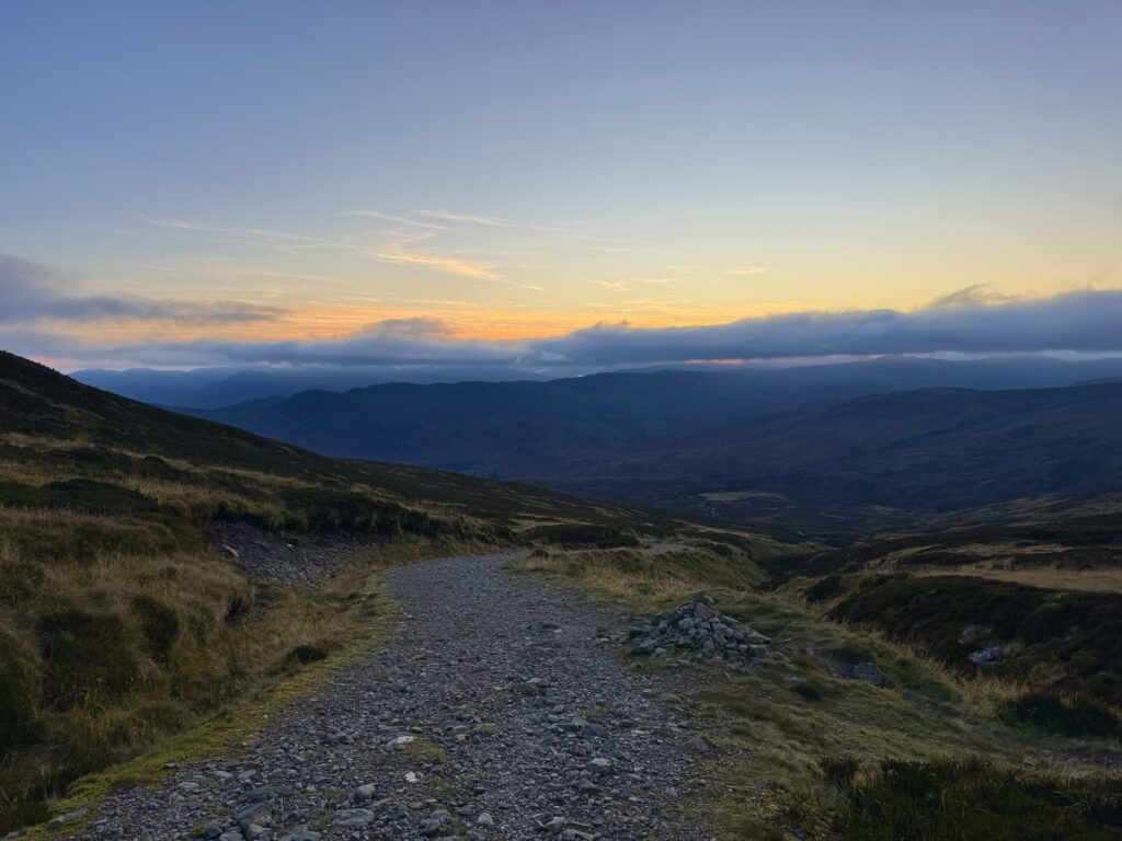
So we got going at a decent pace, under a mix of blue and cloudy skies, with an odd (and perfect) October warmth in the air — it was around 17°C (and this is Scotland!). It was clear we would head into clouds at some point, though; the peak of Ben Chonzie was hiding. Seeing that, I was a bit concerned that the views might not be worth the climb. Little did I know, they were about to work some magic and create a dreamscape.
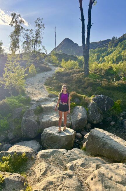
An Easy Start (Wide Paths & Gentle Climbing)
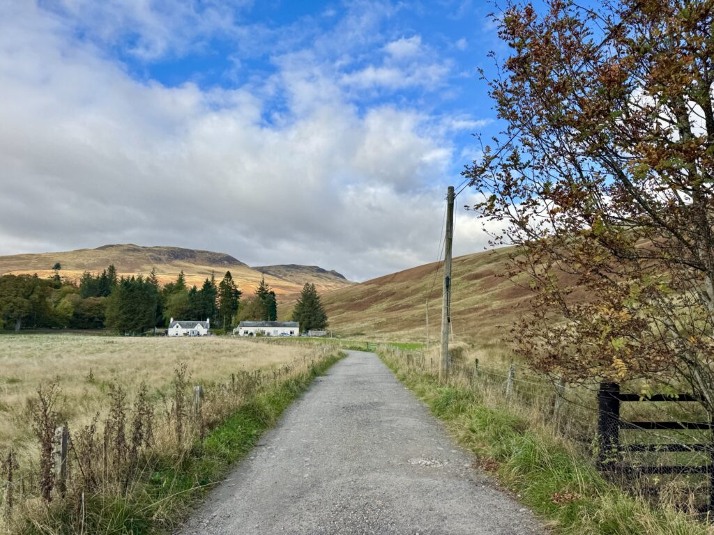
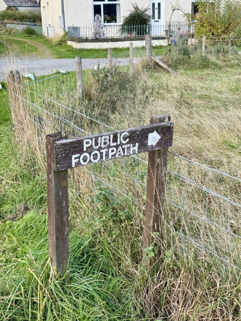
Leaving the parking area, you head towards the cottages.
By them, a ‘public footpath’ sign marks the trailhead. From the beginning, the path is easy in various ways – it’s a clear, relatively wide gravel path with a gentle climb.
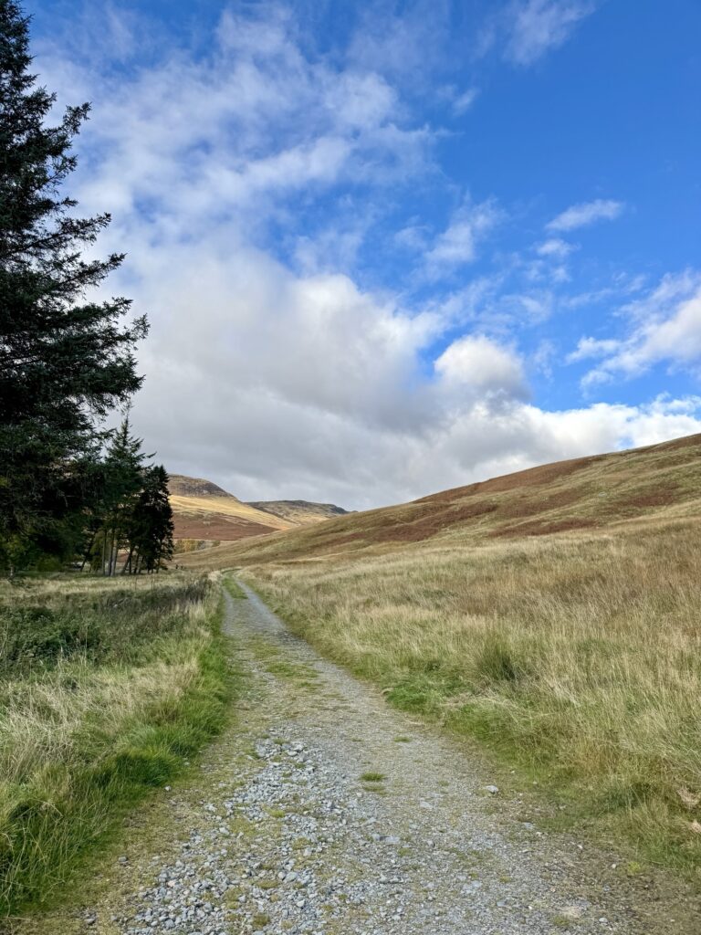
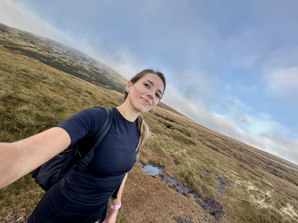
The first section feels pretty flat, and you don’t really notice much of a climb. You’ll cross a small stream (Invergeldie Burn), and pass through a gate soon after.
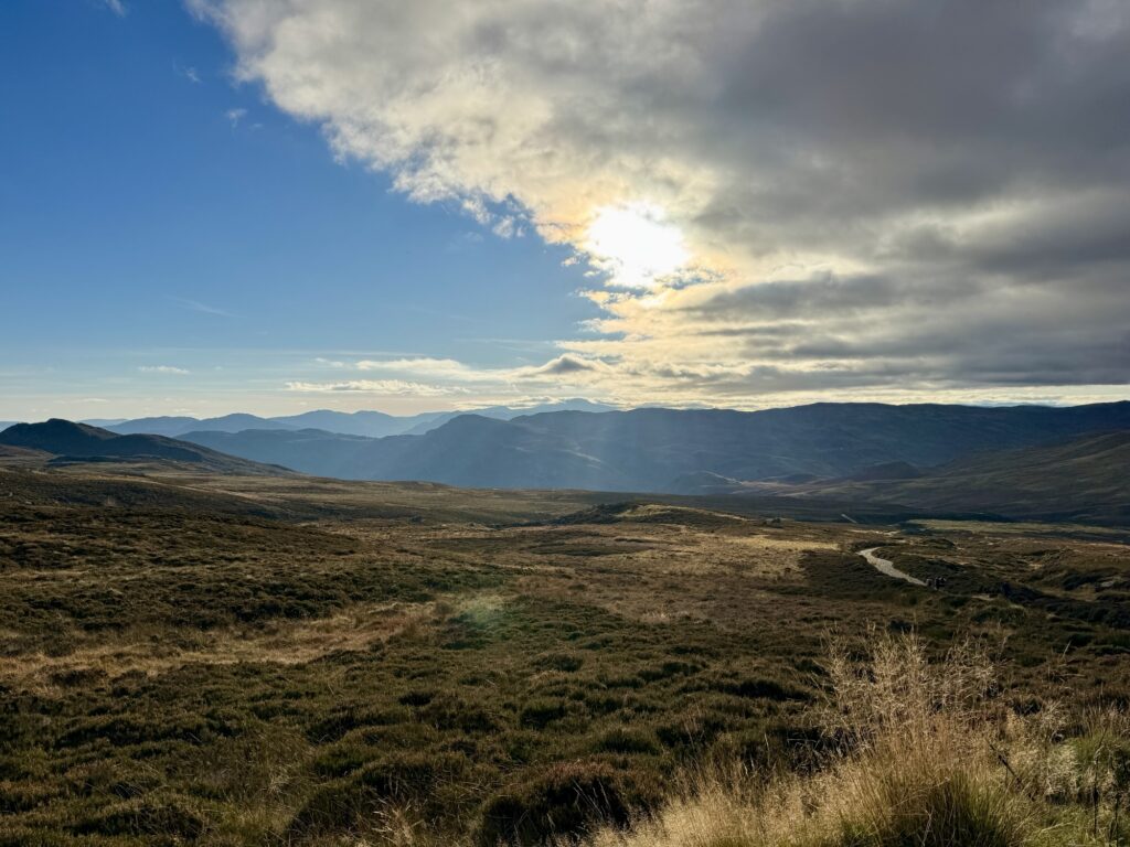
The surroundings are open and expansive: classic Scottish Highland moorland, with the heather more brown than pink at this time of year. Visit during late summer for more colourful scenes!
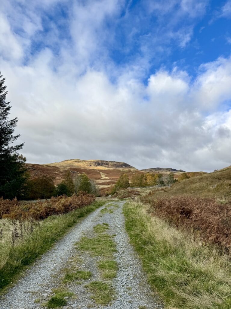
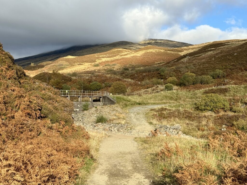
A little further on is a dam, which you keep on your left, continuing along the main track. In the photo below you can see the dam and also the peak covered with cloud!
The Long, Steady Ascent (Simple but Repetitive)
From here, expect to see more of the stream as you ascend. Not long after the dam, it runs alongside the path, providing a soothing soundtrack as you climb.
While the walk up Ben Chonzie is arguably not the most ‘exciting’ in terms of changing scenery – the views don’t change much until the final section – I was just so happy to be out on a nature-filled adventure day that I loved it!
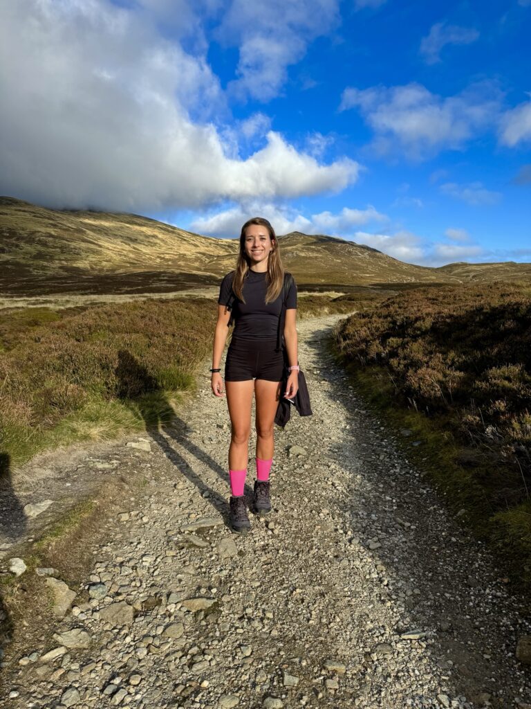
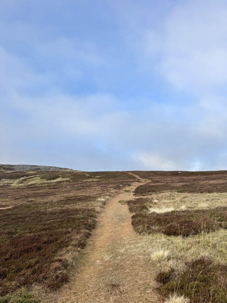
I found it easy to switch off and simply enjoy the walk. The route isn’t technical and is very easy to follow It remains much the same for the majority of the walk… but that does change slightly for the final section.
There’s a little bit of a steeper climb, and then it flattens out – the start of the summit plateau. This initial flatter area was quite boggy. I was definitely glad I had hiking boots for this section, whereas my Mum, who had been fine in her trainers until now, was wishing she had some! Luckily, it was just a few patches; the gravel path gave way to grassy ground, though after heavy rainfall it could get pretty soggy.
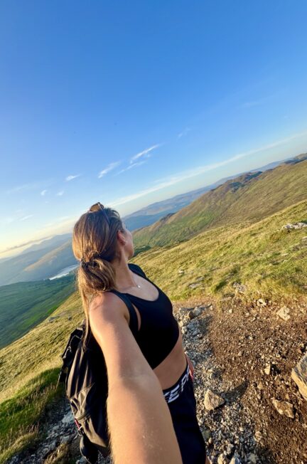
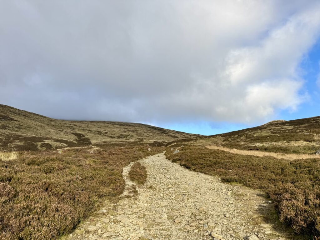
The Summit Plateau (Navigation Caution)
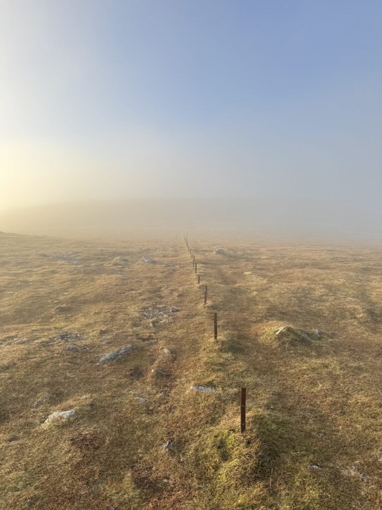
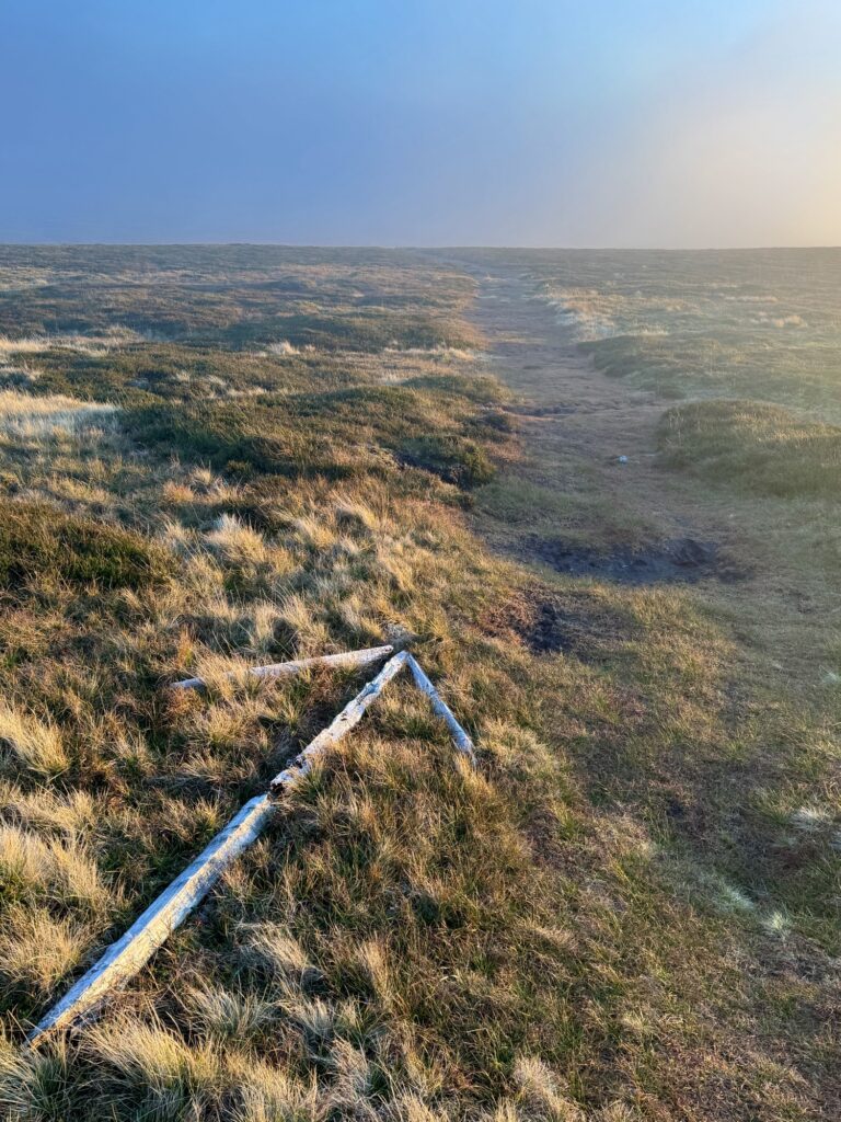
⚠️ Warning: The summit plateau is wide, flat, and can be very disorienting in mist or low cloud 🌫️. It’s easy to lose your way, especially later in the day with fewer hikers around. Stick close to any markers like rusted fence posts 🪵 or rock arrows 👣, and pay full attention to the direction you’ve come from – this is not the time to wander when hiking Ben Chonzie!
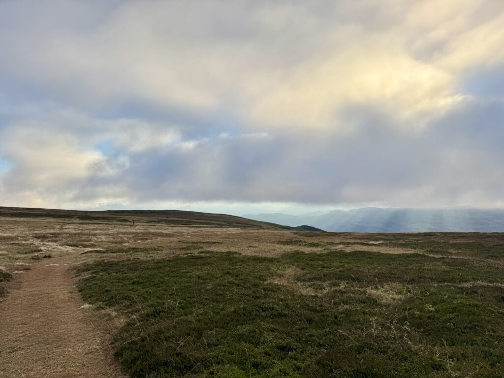
Ben Chonzie’s summit is a vast plateau. This is where you have to be careful.
By the time we reached this section, we had fully entered the cloud. Visibility dropped quickly, and the clear views we’d had earlier were gone. The mist only continued to thicken, and with no one else around to follow to the summit (a downside of hiking later in the day), it suddenly felt a lot more serious up here. The photos below don’t do the mist justice, or maybe I just didn’t take any at the worst parts as I was trying not to go off route!!
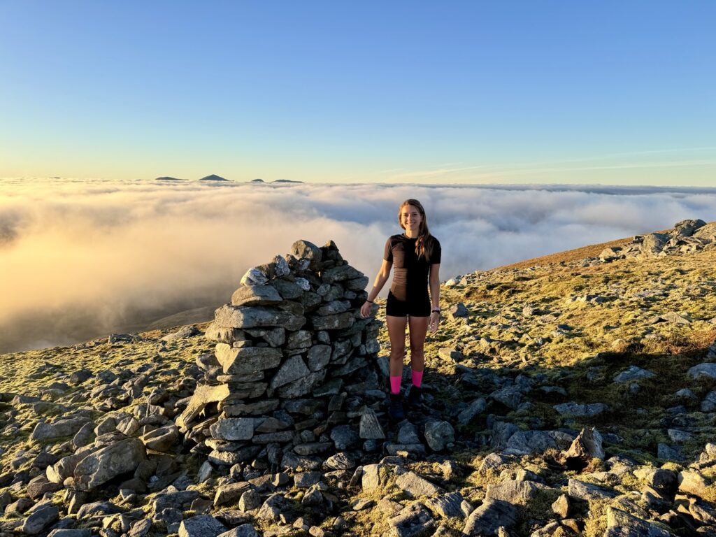
In good conditions, reaching the summit is simply a case of following the path towards the large cairn (there is no trig point on Ben Chonzie). But in mist or low cloud, this wide, flat plateau can become surprisingly disorientating.
It can be easy to drift off track, and while I didn’t, I very easily could have. I’m so glad I’d read up on this beforehand, as it meant I was extra aware of my surroundings and the direction we’d come from, and where we were headed. The ground flattens out, there are very few standout features, and without care, everything starts to look the same.
There are small rusted fence posts along the plateau. These are key – I stuck close to them the whole way, I do recommend to do the same.
At this point, I slowed right down and went into full focus mode. The mist swallowed all views, and the only other hikers around were a couple heading back, who also looked a little disorientated. It was eerie, but in a strangely cool way. I was glad I wasn’t alone and knew to stick to the fence posts. I did wonder if it was safer to turn back, especially with sunset approaching and the very limited visibility, but we kept going.
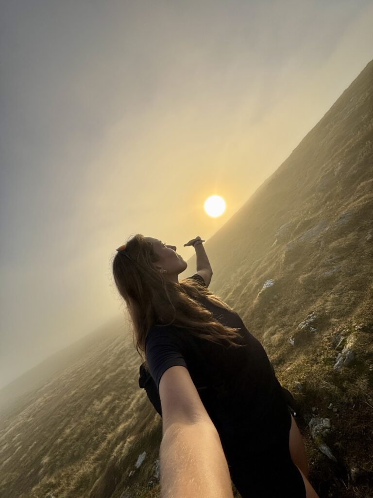
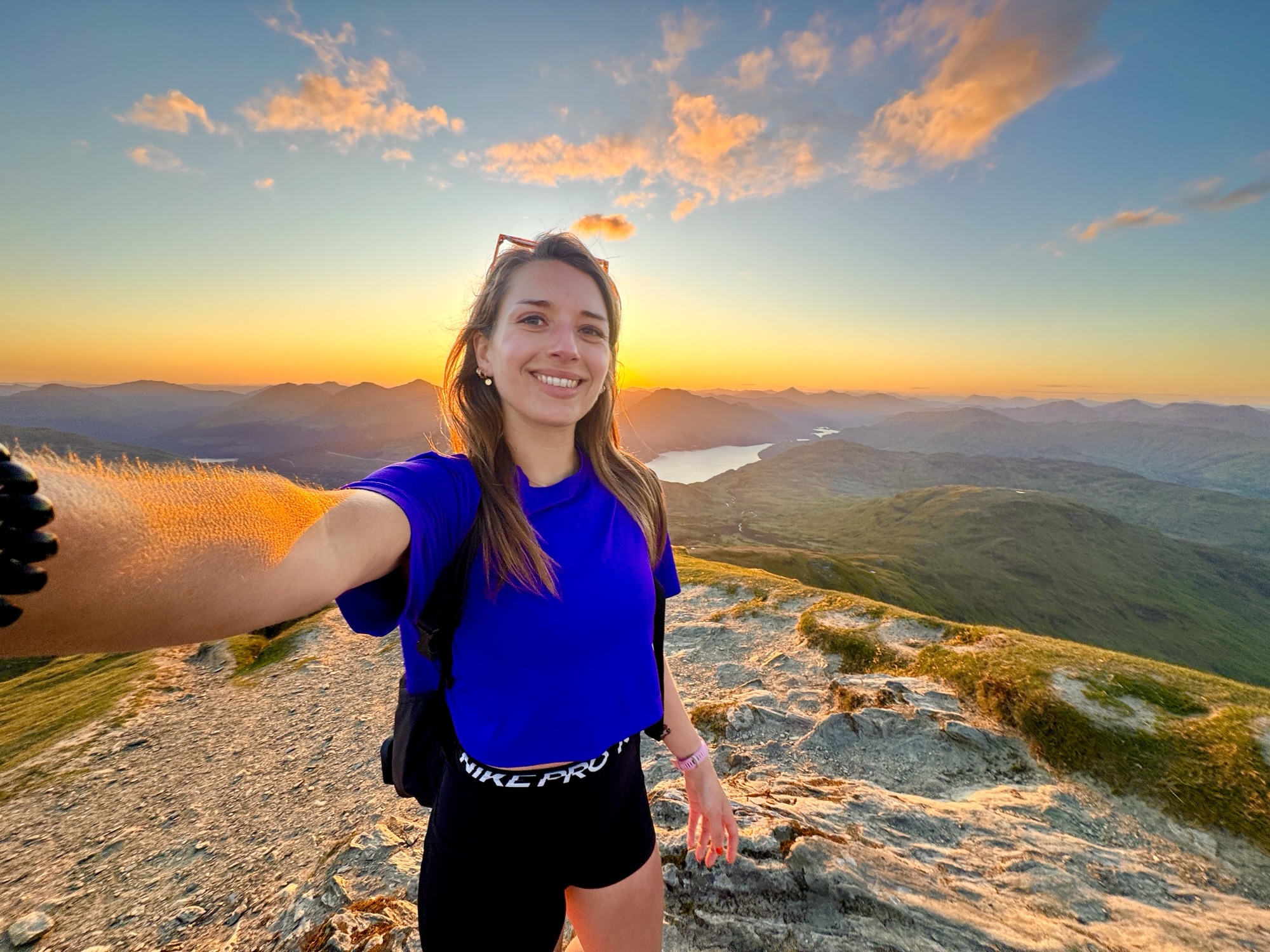
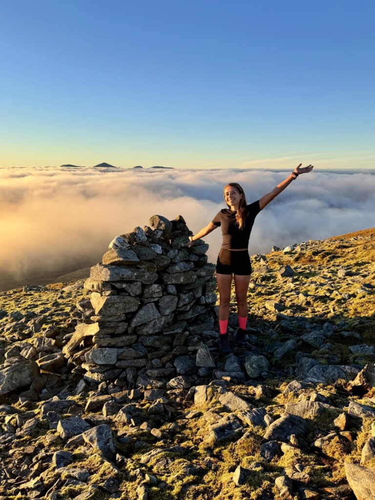
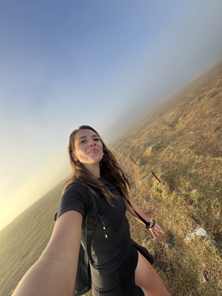
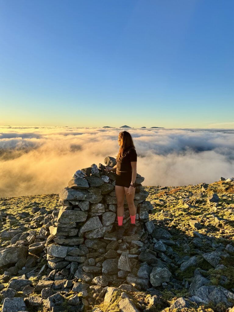
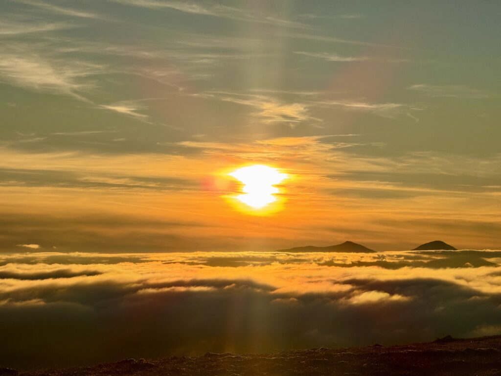
And wow, were we rewarded.
The Reward (Cloud Inversion Magic)
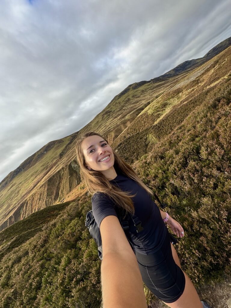
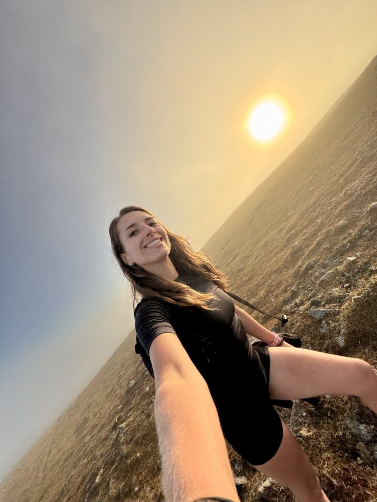
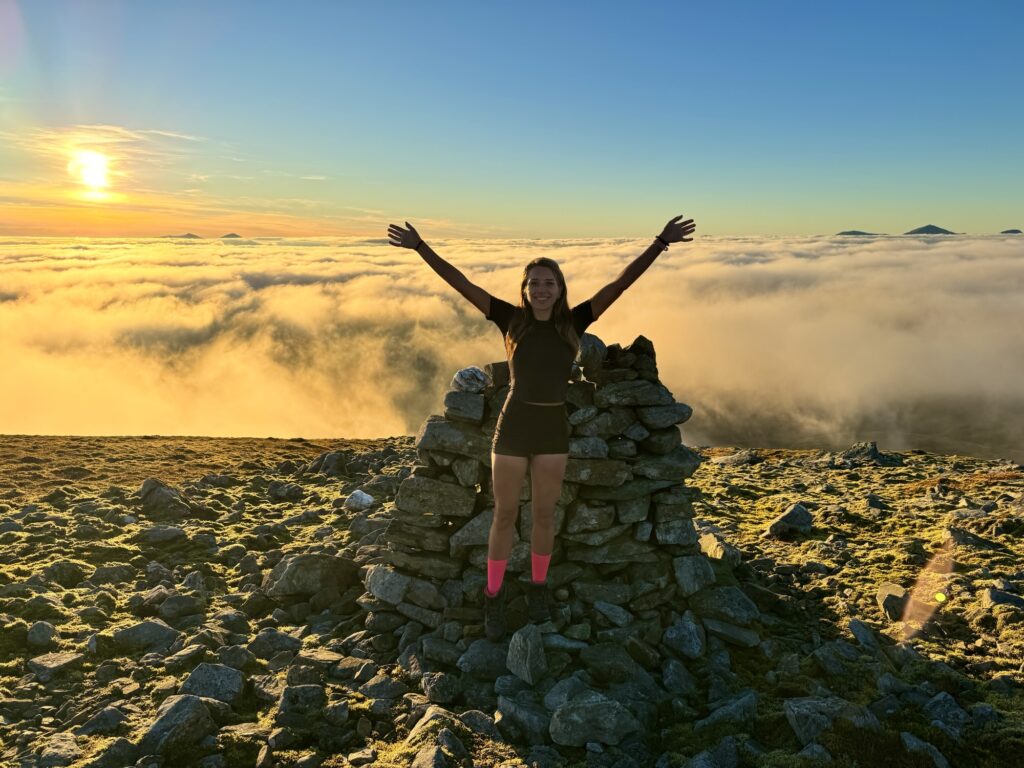
Almost out of nowhere, the mist opened up. Not to sweeping landscape views, but to something even more special. We were suddenly above the clouds, blue sky overhead, the sun shining, and nearby mountain peaks poking out of the white cloud. It was the most beautiful and unexpected cloud inversion. From thinking there would be no views at all… to this. Wow.
After such a steady, chill climb with nice scenes but nothing too remarkable, hiking Ben Chonzie had suddenly transformed into something truly magical.
Now, I’ll be honest, we didn’t actually reach the official summit. Still slightly disorientated (and very overexcited by the cloud inversion!), I spotted a cairn – one a little bigger than some of the others we’d already passed – and assumed that must be it. In reality, the true summit is a couple of hundred metres further on (whoops!). But that really just highlights how confusing the plateau can be in poor visibility, especially with trig point (which would be more obvious than knowing which of the multiple piles of rocks!) to aim for.
The Descent (Concentration Required)
I could have stayed up there for ages, but the sun was about to set, and we still had the entire descent to go.
As we started back, it wasn’t long before we walked right back into the mist-engulfed plateau, turning the return into another concentration challenge. It would have been so easy to go wrong. The little fence posts were a lifesaver, as was carefully recalling where we’d come from, along with the makeshift arrows other hikers had formed out of rocks to point the way back. Their presence highlights just how common it is to become disoriented up here.
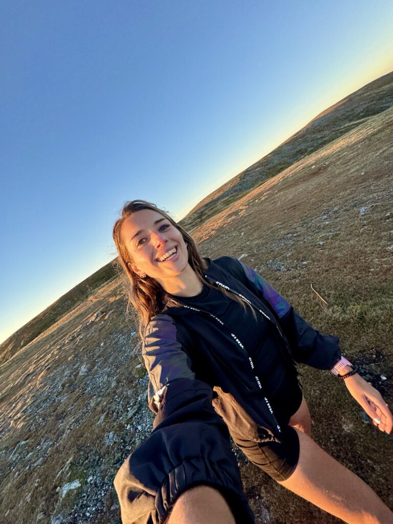
Finally back on the main track after the plateau, I was relieved knowing we’d navigated it safely. The path was now straightforward and easy to follow, leaving the mist behind on the plateau and heading towards the sunset skies. It was just a matter of moving quickly to beat the darkness, which we almost did. I did take out my torch for the last section back to the car park, but with the path so easy here, moving quickly wasn’t a problem.
Is Hiking Ben Chonzie Worth It?
Hiking Ben Chonzie is definitely worth it. With gentle climbs, wide-open paths, and the chance for a little Highland magic if you catch a cloud inversion like I did, it can make for a great morning or afternoon out. It was exactly what I wanted that day: I loved the straightforward route that let me walk quickly, and the gradual climb that had me questioning if I was already on the summit plateau!
Just remember: it’s still a Munro, so bring layers, some fitness, sturdy boots, water, snacks, a torch (if hiking later in the day like I did), and most importantly, keep an eye on the open, sometimes misty summit plateau.
Looking for a slightly tougher climb?
If you’re after more challenge and even bigger views than from Ben Chonzie (unless you’re lucky enough to catch a cloud inversion), you might consider hiking Ben Lomond (check out my post here) or Ben Vorlich (Loch Earn). The views from Ben Lomond in particular are amazing!